Itaile
Geography of Itaile
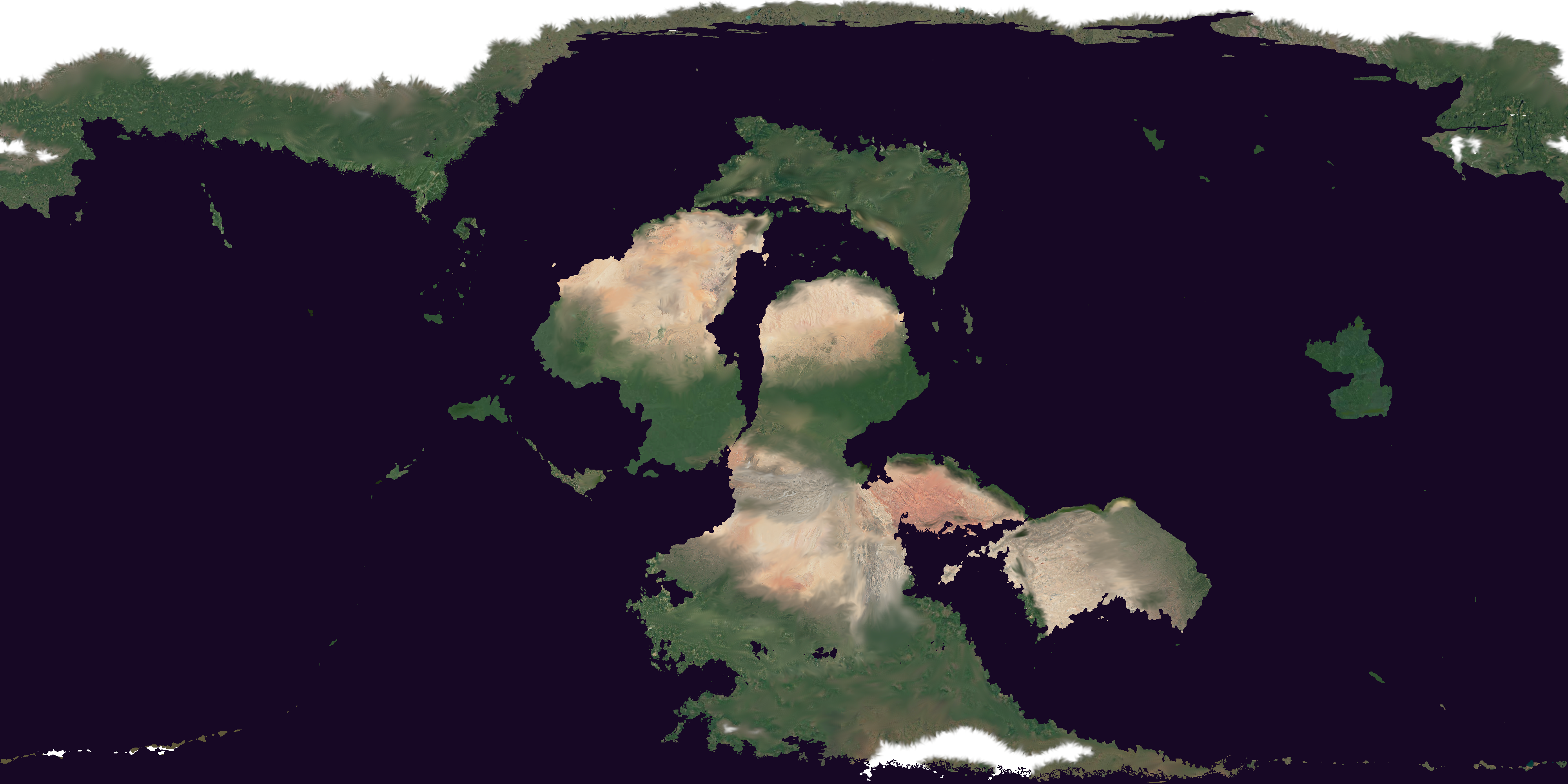
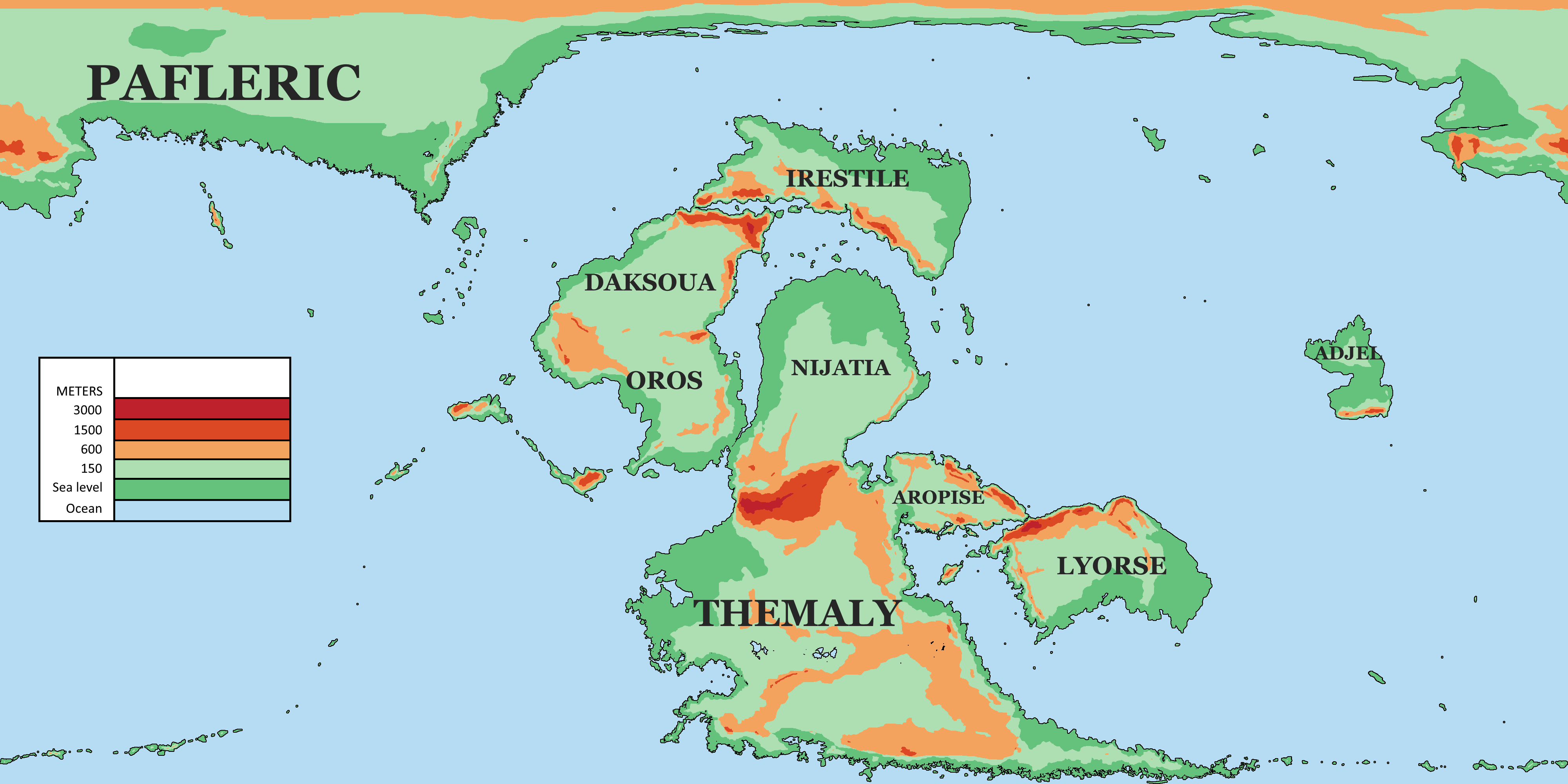
Itaile's geography is very similiar to earth's with the exception of the arrangement of the tectonic plates. In contrast to two large landmasses stretching over almost all latitudes, Itaile has one "pangea" like continent stretching north to south with two disconnected continents. One smaller, tropical island and one large polar continent. The climate and terrain of Itaile follows the same pattern as earth, as you will see. An island chain runs across the 80 degree latitudes to the south while many islands lie to the west of Oros. Itaile has many enclosed seas which foster trade for the locals.
Itailen Topography
Itaile has several tall mountain ranges caused by plate tectonic interactions. The major ones are the Ijopeka plateau in the center and the Lipouets to the east and Mote-Ryujo mountains to the north.
Topography of Themaly
Themaly, the second largest continent consists of 5 different mountain ranges. The Ijopeka plateau to the north, the Etjik mountains to the east and the Oryomeks to the south shield the continent from any rain clouds, making the northern half of the continent extremely dry. The two mountain ranges on the interior are named the Aetjon and the Mehifnes. They are too gradual to make any noticeable change in rain patterns but are significantly colder and have played an important role in the history of Itaile. Between these ranges are 3 large basins known as the Omjeterian basin to the north, the Werabian basin in the center and the Kijowinian basin to the south. These all hold large river networks too while the Werabian basin is home to 6 large lakes called the Rouch lakes while the collection of lakes in the east is called the Enemetl lakes.
The western coast is dotted in countless lakes while peninsulas stretch out into the sea with archipelagos.
Topography of Aropise
Aropise is dominated by the large Aropisan basin and the surrounding mountains. The southern mountains are called the Authijes and the northern mountains are called the Aekopetese mountains. The Efinaric mountains which are part of the Lipouets border the Aropisan basin to the west. The central plain is relatively flat with deep gorges formed by the Chitak river system. The central Aropisan plain is divided in west and east by the Hijihemos that connect with the Aekopetese mountains to the north. The Aekopetese mountains have 2 parallell ridges with a plateau in the middle that host separate societies and cultures.
Topography of Lyorse
The Aekopetese mountains continue into the Jiarees on the other side of the Injelian strait. The Jiarees are taller and continue a few thousand kilometers east, they connect with the Manefirs that run north to south on the western side of Lyorse. The Vepaerese mountains run north to south on the eastern side of Lyorse but they are more gradual. Between the Jiarees and the Manefirs lies the great White Plain which is very dry and between the Manefirs and the eastern coast lies the Lyorsian Plain which is connected to White Plain with a narrow passage on the southern coast.
Topography of Nijatia
Nijatia is the flattest continent with the only mountains to the south. The Ijopeka plateau borders the continent to the south and connect to the Foggy Mountains. They run north to south on the southwestern part of the continent with a huge plateau in the center. The Aeolific Highlands lie to the north of these mountains. To the east lies the Asuroi Mountains that run diagonally south-west.
Topography of Oros
There are four large mountain ranges in Oros. The Asikhemes to the north, the Amijuory mountains to the west, the Malirishas to the east and in the center/south lie the Lefiese Mountains that stretch out into the Jachipsies to the west. The Jachipsies are a collection of islands that form an enclosed sea called the bay of Ghamat. In the center of Oros lie the large Orosian plains. Oros is also connected to Nijatia by a thin strip of land and the long bay called the Araiciz Sea which is only a few hundred or a thousand kilometers wide.
Topography of Daksoua
Oros and Daksoua connect through the Asikhemes. Daksoua is also shielded to the East and North known as the Mote-Ryujo mountains to the north and the Izhitese highlands to the east. The west and the Eliriti basin are incredibly flat areas, the Eliriti basin lies just west of the Izhitese highlands.